No Warnings, Watches, or Advisories

Left click to see a larger image.
Regional Infrared Satellite Regional Infrared Satellite
  • Holder

    Scroll Left/Right or click on dots to see other images. Check Date of image. Left click to see a larger image.

    spacer
    METRIC | IMPERIAL
    Updated: 26-Apr-2024 @ 5:10am   (0 sec ago)
    Temperature Current Conditions Forecast / Storm Prediction
    Currently Outside: Colder 0.3°F than last hour.

    47.5°F

    Feels like:  43°F
    ---
    High Today
    49.8°F
    12:00 AM
    Low Today
    47.4°F
    4:53 AM
    Yest High
    65.9°F
    3:45 PM
    Yest Low
    35.2°F
    6:25 AM
    Sta* High
    59.1°F
    2023
    Sta* Low
    25.0°F
    2023
    * This Station's Records Since 1/2014
    Night time, Dry, Clear skies Night time, Dry, Clear skies

    Wind from ESE Wind:  ESE
    9.7

    Gusting to:
    10.0 mph
    Current Rain Rain:
    0.00 in
    Chandler Burning Index: LOW Current CBI
    Fire Danger:
    14.2 of 100
    Overnight

    Overnight: Mostly Cloudy
    Mostly Cloudy
    Friday

    Friday: Rain Showers
    Rain Showers
    Friday
    Night
    Friday Night: Showers And Thunderstorms
    Showers And T-Storms
    Lo 44°F Hi 52°F Lo 51°F
    SPC Activity Map
    Dew Point Liquid Precipitation Wind Speed Sun/Moon
    Current: Decreased 0.3°F since last hour. 30.7°F
    Last Hour: Decreased 0.3°F since last hour. -0.3°F
    High 4:01 AM: 31.0°F
    Low 1:27 AM: 26.9°F
    Record High: 84.7°F on
    23-Aug-2023
    Record Low: -42.5°F on
    31-Jan-2019
    Wetbulb: 41.0°F
    Leaf Wet:7 0
    Today: 0.00 in
    Yesterday: 0.00 in
    Last 7 Days: 0.00 in
    Apr Rain: 1.64 in
    Apr to Date
      Avg:10
    0.00 in
    Apr to Date
      Diff from Avg:10
    Over 1.64 in for the month 1.64 in
    Apr Avg: 2.46 in
    Diff from Avg: Under 0.82 in for the month 0.82 in
    Season:1 4.22 in
    YTD
      Avg:11
    2.79 in
    YTD
      Diff from Avg:11
    Over 1.43 in for the year 1.43 in
    Last Rain
    Time/Date:
    18-Apr-2024
    at 5:53 AM
    17 rain days in 2024
    7 days in April
    7 days since last rain
    Current: ESE  9.7 mph
    1Hr Average: 8.5 mph
    Wind Run: 38.12 miles
    Wind Gust
    Current: 10.0 mph
    Today: 21.0 mph 3:56 AM
    Month: 35.0 mph 22-Apr
    Year: 35.0 mph 22-Apr
    Record Gust: 44.0 mph
    16-Dec-2021
    Sunlight:
    14 h 0 m 42 s
    of Sunlight Yesterday
    14 h 3 m 26 s
    of Sunlight Today
    Which is
    2 min 44 sec longer than
    yesterday
    14 h 6 m 10 s
    of Sunlight Tomorrow
    (Noon ?>) graph (Midnight
    Legend

    Waning Gibbous
    Waning Gibbous, 17 days, 15 hours, 50 minutes in cycle
    94%
    Illuminated
    Humidity Barometer
    Current: No Change 52%
    Last Hour: No Change 0%
    High 4:01 AM: 52%
    Low 12:00 AM: 42%
    Record High: 100%
    8-Aug-2018
    Record Low: 0%
    11-Jun-2016
    Current: Falling 0.037  inHg/hr 29.900 inHg
    Last Hour: Falling
    High 12:00 AM: 30.032
    Low 5:08 AM: 29.899
    Record High: 30.971 inHg
    7-Jan-2015
    Record Low: 25.396 inHg
    11-Jun-2016
    Heating Degree Days Lightning Strikes Wind Chill Air
    Today: 3.3
    Apr: 476.9
    2024 to Date: 3714.2
    Cooling Degree Days
    2024 to Date: 0.0
    Last Min: 0
    Last 5 Mins: 0
    Last 30 Mins: 0
    Last 60 Mins: 0
    Last 12 Hrs: 0
    Apr: 43601
    2024 to Date: 66832
    Last
    Strike:
    05:09:48
    26-Apr-2024
    Last Bearing: 191
    Last Distance: 253 miles
    Current: 43.1°F
    Low 4:58 AM: 41.9°F
    Yesterday: 34.0°F
    Record: -46.1°F
    29-Jan-2019
    Quality
    Index6:

    28


    Good
    Density:
    1.25 kg/m3
    UV Summary/Forecast Solar Summary
    High Yest:   0.0 @ 12:00 AM
    Apr-26

    6.4
    Apr-27

    6.3
    Apr-28

    6.8
    High Yest:   888.0 @ 1:59 PM
    Sun Hours Today:
    00:00
       This Month: 86:37 Hrs
    Rise: 6:08 am  Set: 8:08 pm
    Soil Conditions8 Irrigation Index5 Station All Time Records Cloud Level
    0.4 in: 36.0 cb | 51°F
    1.2 in: 24.0 cb | 50°F
    2.4 in: 20.0 cb | 48°F
    3.6 in: 5.0 cb | 47°F

    Growing conditions
    at the depth of:  0.4 in:


    Soil moisture range is from
    0-Wet to 200-Dry/Frozen
    Updated at Midnight
    Current ET: 0.09 in
    7-Days Rain: 0.00 in
    7-Days ET: 1.01 in
    7-Day:  1.008 in water in deficit of what evaporated in last 7 days. 1.008 in
    April:  1.24 in water in deficit of what evaporated this month. 1.24 in
    HIGHS: LOWS:
    97.5°F
    3-Sep-2023
    -33.5°F
    31-Jan-2019
    Daytime Records
      94.8°F°F
    03-Sep-2023
      -17.3°F°F
    30-Jan-2019
    Nitetime Records
      83.1°F°F
    23-Aug-2023
      -28.1°F°F
    31-Jan-2019
    ICN:1 | S3C2:3 | Ajax 3.xx
    ISS:Ok | CON:4.7 | RCP:100%
    1 Rain season: Jan 1st to Dec 31st.   2 Snow season July 1st to June 30th.   3 Snow manually measured usually around 7AM and 7PM.   5 Estimated amount of water needed to replace the water used by plants and evaporation from the past week. (Negative numbers mean amount of water needed, positive numbers mean excess water is present).   6 Air Quality Index is provided by Minnesota Polution Control Agency and is updated hourly between the hours of 6AM and Midnight.   7 Leaf Wetness is surface moisture on foliage. 0 being totally dry and 15 being totally saturated.   8 Soil moisture and temperatures are from sensors burried in the ground at the levels specified.   10 Historical average only to day 26 of just the month of April for this station since 2014.   11 Historical average rain this season to day 26 of April for this station since 2014.
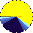
     NWS Weather Forecast  -   Outlook Overnight & Friday
    Overnight

    Overnight: Mostly Cloudy
    Mostly Cloudy

    Lo 44°F
    NWS forecast: Mostly cloudy, with a low around 44. Southeast wind around 20 mph, with gusts as high as 30 mph.
    WXSIM forecast: Mostly cloudy. Breezy. Low 47°. Wind east-southeast around 14 mph, gusting to 22 mph.
    Local station forecast: Increasing clouds and cooler, precipitation possible and windy within 6 hrs.
    Friday

    Friday: Rain Showers
    Rain Showers

    Hi 52°F
    NWS forecast: Rain showers between 8am and 1pm, then showers and thunderstorms. Cloudy. High near 52, with temperatures falling to around 49 in the afternoon. Southeast wind 20 to 25 mph, with gusts as high as 40 mph. Chance of precipitation is 90%. New rainfall amounts between a quarter and half of an inch possible.
    WXSIM forecast: Dense overcast. A chance of rain in the morning, then rain likely in the afternoon. Windy and cool. High 50°, but temperatures falling in the afternoon. Wind chill ranging from 37 to 43. UV index up to 2. Wind east-southeast around 17 mph, gusting to 25 mph. Chance of precipitation 80 percent. Precipitation mostly around half an inch.
     NWS Short Term Weather Forecast
    Friday
    Night
    Friday Night: Showers And Thunderstorms
    Showers And T-Storms
    Saturday

    Saturday: Slight Chance Showers And Thunderstorms then Mostly Cloudy
    Slight Chance Showers And T-Storms then Mostly Cloudy
    Saturday
    Night
    Saturday Night: Showers And Thunderstorms Likely
    Showers And T-Storms Likely
    Sunday

    Sunday: Showers And Thunderstorms Likely then Showers And Thunderstorms
    Showers And T-Storms Likely then Showers And T-Storms
    Sunday
    Night
    Sunday Night: Showers And Thunderstorms
    Showers And T-Storms
    Monday

    Monday: Chance Showers And Thunderstorms
    Chance Showers And T-Storms
    Monday
    Night
    Monday Night: Partly Cloudy
    Partly Cloudy
    Lo 51°F Hi 66°F Lo 49°F Hi 62°F Lo 47°F Hi 57°F Lo 42°F
    ajax-dashboard6.php - Version 6.95g - 18-Feb-2023 - Script by: Scott of BurnsvilleWeatherLIVE.com
    Now supported by Saratoga-weather.org Download
    Countdown to Summer
     Summer Solstice begins June 20th at 3:51pm   CDT